

Select Category
_0x200.jpg)
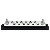
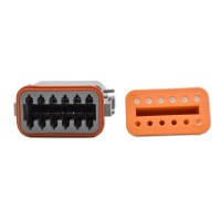
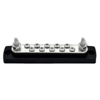
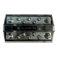
Bluewater 12 Position Male Sealed Deutsch Connector Busbar - 5/16" Stud
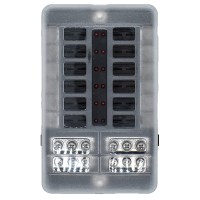
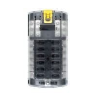
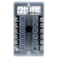
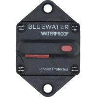
Bluewater 12 Position Fuse Block ATC w/Yellow Slide


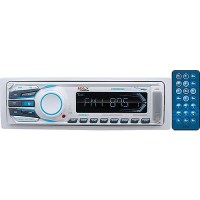
Bluetooth® Digital Media Am/Fm/Usb/Mp3/Sd/Aux Mech-Less Receiver - Mr1308Uab - 153-Mr1308Uabf1
50 Watts x 4 channels Chassis mounting: single DINFront AUX-InputDetachable front panel30 stations presetWireless remote controlSwitchable radio regions: USA, EuropeMech-Less disk player, compatible: MP3, WMACompatible with audio output of iPod/iPhone & other MP3 players
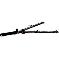
Blueox Bx4370 Ascent Aluminum Tow Bar - Bx4370 - 123-Bx4370F1
A light-weight, 31-pound tow bar that is self-aligning, allowing for quick and easy hook-up. Components machined from aircraft grade aluminumShimmering metallic accented powder coat
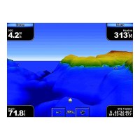
Bluechart® G3 Vision Card, South Maine - 010-C0703-00 - 322-010C070300F1
Plug a BlueChart g3 Vision card into your compatible device's SD™ card slot and tremendously expand its mapping capabilities. High-resolution satellite imagery enhances chart depictions for superior situational awareness so you can navigate with a clear moving-map representation of your boat's position. It's the most realistic mapping display Garmin has ever offered in a chartplotter. High resolution satellite imagery, when overlaid on the chart, provides the mariner with unparalleled situational awarenessAerial reference photography provides "real world" photos of ports, harbors, marinas, waterways, navigation landmarks and other points of interest, offering the mariner another powerful tool for navigating unfamiliar watersMariner's Eye View perspective provides a bird's eye view from behind the boat showing the chart information for a quick, reliable and easy position fixFish Eye View 3D perspective provides an underwater view that visually represents the sea floor according to the chart's informationAuto Guidance technology searches chart data to suggest the best passage to a destinationFishing charts allow the mariner to hide navigation data from the SD card while leaving the bottom contours and depth soundings for their next fishing adventureIncludes tides, currents, marine services, coastal roads and points of interestDetailed BlueChart g3 maps are include 500, 600, 700, 4000, 5000, 6000, 7000
Bluechart® G3 Vision Card, New York - 010-C0705-00 - 322-010C070500F1
Plug a BlueChart g3 Vision card into your compatible device's SD™ card slot and tremendously expand its mapping capabilities. High-resolution satellite imagery enhances chart depictions for superior situational awareness so you can navigate with a clear moving-map representation of your boat's position. It's the most realistic mapping display Garmin has ever offered in a chartplotter. High resolution satellite imagery, when overlaid on the chart, provides the mariner with unparalleled situational awarenessAerial reference photography provides "real world" photos of ports, harbors, marinas, waterways, navigation landmarks and other points of interest, offering the mariner another powerful tool for navigating unfamiliar watersMariner's Eye View perspective provides a bird's eye view from behind the boat showing the chart information for a quick, reliable and easy position fixFish Eye View 3D perspective provides an underwater view that visually represents the sea floor according to the chart's informationAuto Guidance technology searches chart data to suggest the best passage to a destinationFishing charts allow the mariner to hide navigation data from the SD card while leaving the bottom contours and depth soundings for their next fishing adventureIncludes tides, currents, marine services, coastal roads and points of interestDetailed BlueChart g3 maps are include 500, 600, 700, 4000, 5000, 6000, 7000
Bluechart® G3 Vision Card, Jacksonville-Bahamas - 010-C0742-00 - 322-010C074200F1
Plug a BlueChart g3 Vision card into your compatible device's SD™ card slot and tremendously expand its mapping capabilities. High-resolution satellite imagery enhances chart depictions for superior situational awareness so you can navigate with a clear moving-map representation of your boat's position. It's the most realistic mapping display Garmin has ever offered in a chartplotter. High resolution satellite imagery, when overlaid on the chart, provides the mariner with unparalleled situational awarenessAerial reference photography provides "real world" photos of ports, harbors, marinas, waterways, navigation landmarks and other points of interest, offering the mariner another powerful tool for navigating unfamiliar watersMariner's Eye View perspective provides a bird's eye view from behind the boat showing the chart information for a quick, reliable and easy position fixFish Eye View 3D perspective provides an underwater view that visually represents the sea floor according to the chart's informationAuto Guidance technology searches chart data to suggest the best passage to a destinationFishing charts allow the mariner to hide navigation data from the SD card while leaving the bottom contours and depth soundings for their next fishing adventureIncludes tides, currents, marine services, coastal roads and points of interestDetailed BlueChart g3 maps are include 500, 600, 700, 4000, 5000, 6000, 7000
Bluechart® G3 Vision Card, Florida - 010-C0712-00 - 322-010C071200F1
Plug a BlueChart g3 Vision card into your compatible device's SD™ card slot and tremendously expand its mapping capabilities. High-resolution satellite imagery enhances chart depictions for superior situational awareness so you can navigate with a clear moving-map representation of your boat's position. It's the most realistic mapping display Garmin has ever offered in a chartplotter. High resolution satellite imagery, when overlaid on the chart, provides the mariner with unparalleled situational awarenessAerial reference photography provides "real world" photos of ports, harbors, marinas, waterways, navigation landmarks and other points of interest, offering the mariner another powerful tool for navigating unfamiliar watersMariner's Eye View perspective provides a bird's eye view from behind the boat showing the chart information for a quick, reliable and easy position fixFish Eye View 3D perspective provides an underwater view that visually represents the sea floor according to the chart's informationAuto Guidance technology searches chart data to suggest the best passage to a destinationFishing charts allow the mariner to hide navigation data from the SD card while leaving the bottom contours and depth soundings for their next fishing adventureIncludes tides, currents, marine services, coastal roads and points of interestDetailed BlueChart g3 maps are include 500, 600, 700, 4000, 5000, 6000, 7000
Bluechart® G3 Vision Card, Cape Cod - 010-C0704-00 - 322-010C070400F1
Plug a BlueChart g3 Vision card into your compatible device's SD™ card slot and tremendously expand its mapping capabilities. High-resolution satellite imagery enhances chart depictions for superior situational awareness so you can navigate with a clear moving-map representation of your boat's position. It's the most realistic mapping display Garmin has ever offered in a chartplotter. High resolution satellite imagery, when overlaid on the chart, provides the mariner with unparalleled situational awarenessAerial reference photography provides "real world" photos of ports, harbors, marinas, waterways, navigation landmarks and other points of interest, offering the mariner another powerful tool for navigating unfamiliar watersMariner's Eye View perspective provides a bird's eye view from behind the boat showing the chart information for a quick, reliable and easy position fixFish Eye View 3D perspective provides an underwater view that visually represents the sea floor according to the chart's informationAuto Guidance technology searches chart data to suggest the best passage to a destinationFishing charts allow the mariner to hide navigation data from the SD card while leaving the bottom contours and depth soundings for their next fishing adventureIncludes tides, currents, marine services, coastal roads and points of interestDetailed BlueChart g3 maps are include 500, 600, 700, 4000, 5000, 6000, 7000
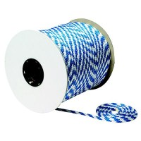
Blue/White Solid Braid Mfp Multi-Purpose Spool (Derby Rope), 3/8" X 500' - 50-42780 - 50-42780F1
Buoyant PolypropyleneMulti-purposeResistant to rot, mildew and marine growth
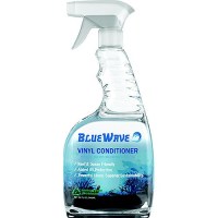
Blue Wave Bws100632 Vinyl Conditioner, 32 Oz. - Bws100632 - 974-Bws100632F1
Eco-Friendly Ready-to-Use FormulaEasy application & quick resultsExtends life of vinyl surfacesProvides UV protectionGenerates waterproof barrierRestores soiled and weathered vinylDeters future soiling and build-up

Blue Wave Bws100532 Complete Marine Cleaner, 32 Oz. - Bws100532 - 974-Bws100532F1
Reef & Ocean FriendlyConcentrated formulaEasy application, quick results with streak-free finishRemoves grease, dirt and spot stainsRefreshing coconut scentCompatible with all washable surfacesSolvent freeCleans vinyl, fabric and leather surfacesSpecialized for decks, gunnels, and hulls